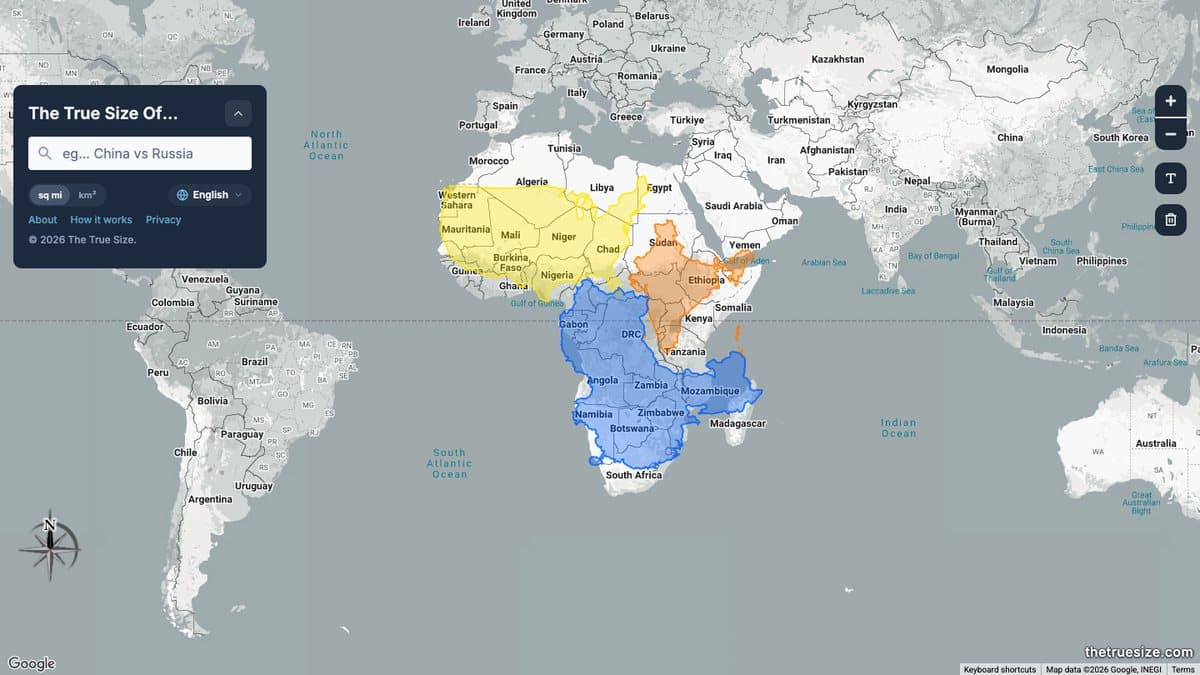
What is The True Size Of?
The True Size Of is an interactive map that fixes a problem most of us grew up with. The Mercator projection on classroom maps stretches land near the poles, so Greenland looks as big as Africa and Russia looks enormous. Here you pick a country, state or region and drag its outline anywhere on the map. As it moves toward the equator it shrinks to its true size, and as it moves toward the poles it swells.
It was made by James Talmage and Damon Maneice, inspired by Kai Krause's infographic The True Size of Africa. They built the first version in 2013, and it took off in 2015 when Damon posted it to a map fan group on Facebook. It reached the front page of Reddit and drew around a million visitors in a day, and true-size maps of Africa keep going viral again.
What You Can Do
- Search for any country, state, province or region
- Drag outlines across the map to compare real sizes
- Rotate shapes to line them up
- Stack several countries on top of each other
- Useful for classrooms and geography lessons
How to Play The True Size Of
- Open thetruesize.com.
- Type a country or region into the search box.
- Drag its coloured outline over another part of the world.
- Add more shapes to compare several places at once.
Is The True Size Of Free?
The True Size Of is free to use with no account. The creators accept optional donations through Buy Me a Coffee.
Who Will Enjoy It?
- Geography fans and map lovers
- Teachers explaining map projections
- Travellers curious how big a country really is
- Anyone who suspects Greenland is not that big
Websites Like The True Size Of
- Ancient Earth: Another map toy, this time showing where your town sat millions of years ago.
- If the Moon Were Only 1 Pixel: A scale model that fixes our sense of distance the way this fixes size.
- Wonders of Street View: Explore real places around the world after comparing their size.
Frequently Asked Questions
Is The True Size Of free?
Yes. The map is free to use with no sign-up. Donations are optional.
Why do countries change size when I drag them?
The base map uses the Mercator projection, which stretches land near the poles. The outline shows the true area at each latitude.
Can I compare US states or provinces?
Yes. You can search for countries, states, provinces and regions.