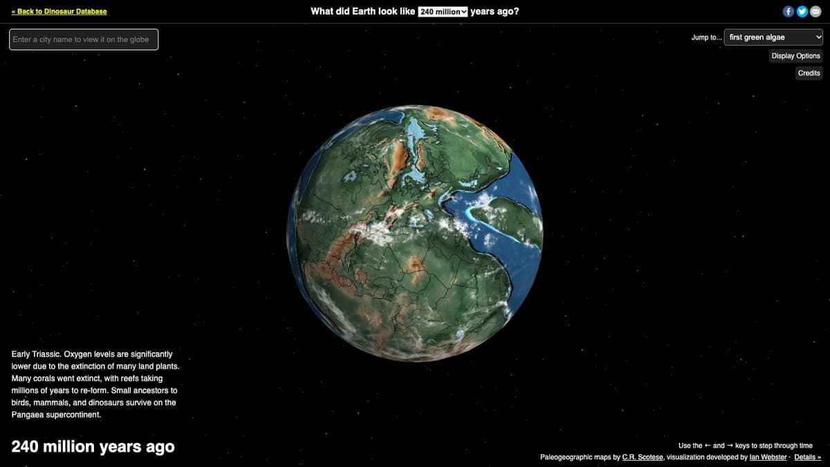
What is Ancient Earth?
Ancient Earth is an interactive 3D globe created by former Google engineer Ian Webster and hosted on DinosaurPictures.org. You type in an address, pick a point in time, and the globe rotates to show where that place was as the continents drifted, from 750 million years ago to the present. The maps come from C.R. Scotese's PALEOMAP Project.
It opens at 240 million years ago, in the Middle Triassic, when the continents were joined as Pangaea, and a drop-down lets you jump to milestones like the first green algae, the first vertebrates or the first hominids. Seeing your own street sitting in the middle of an ocean, or glued to a different continent, is what has made it so shareable. IFLScience, ScienceAlert and Fast Company have all written about it.
What You Can Do
- Enter any address and see where it sat on the ancient globe
- Jump between eras from 750 million years ago to now
- Skip straight to milestones like the first dinosaurs or first flowers
- Read a short description of life and climate in each era
- Spin and zoom the 3D globe freely
How to Play Ancient Earth
- Open dinosaurpictures.org/ancient-earth.
- Type your town or address into the location box.
- Pick an era from the menu or step through time with the arrows.
- Rotate the globe and read the notes about that period.
Is Ancient Earth Free?
Ancient Earth is free to use with no account. There is an optional email list for updates.
Who Will Enjoy It?
- Dinosaur fans of any age
- Teachers and students covering plate tectonics or Earth history
- Curious people who want to see their hometown in a new way
- Map lovers and geography nerds
Websites Like Ancient Earth
- The True Size Of: Another map tool that changes how you see the world's continents.
- Size of Life: A visual journey through living things, from tiny to huge.
- If the Moon Were Only 1 Pixel: Puts the solar system on a scale you can actually feel.
Frequently Asked Questions
Is Ancient Earth free?
Yes. The globe is free to use in the browser with no sign-up.
How far back does Ancient Earth go?
It covers 750 million years ago up to the present day.
Where does the map data come from?
The paleogeographic maps come from C.R. Scotese's PALEOMAP Project.